Smart Mining & Volumetrics
Precision Mining Solutions
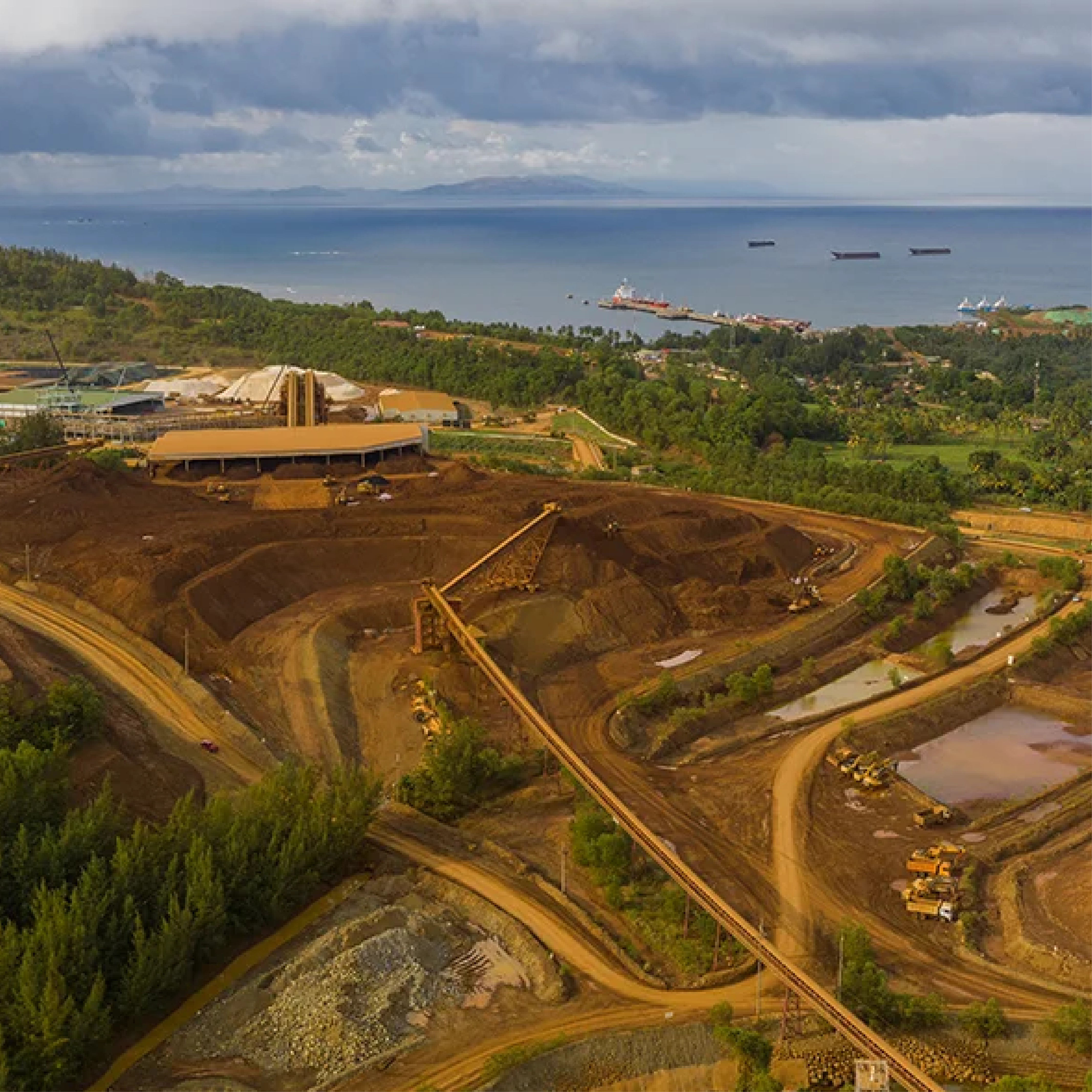
We provide a comprehensive range of mining services from exploration to reclamation. Using advanced drone technology, we deliver highly accurate volumetric data and topographical models 10x faster than traditional methods.
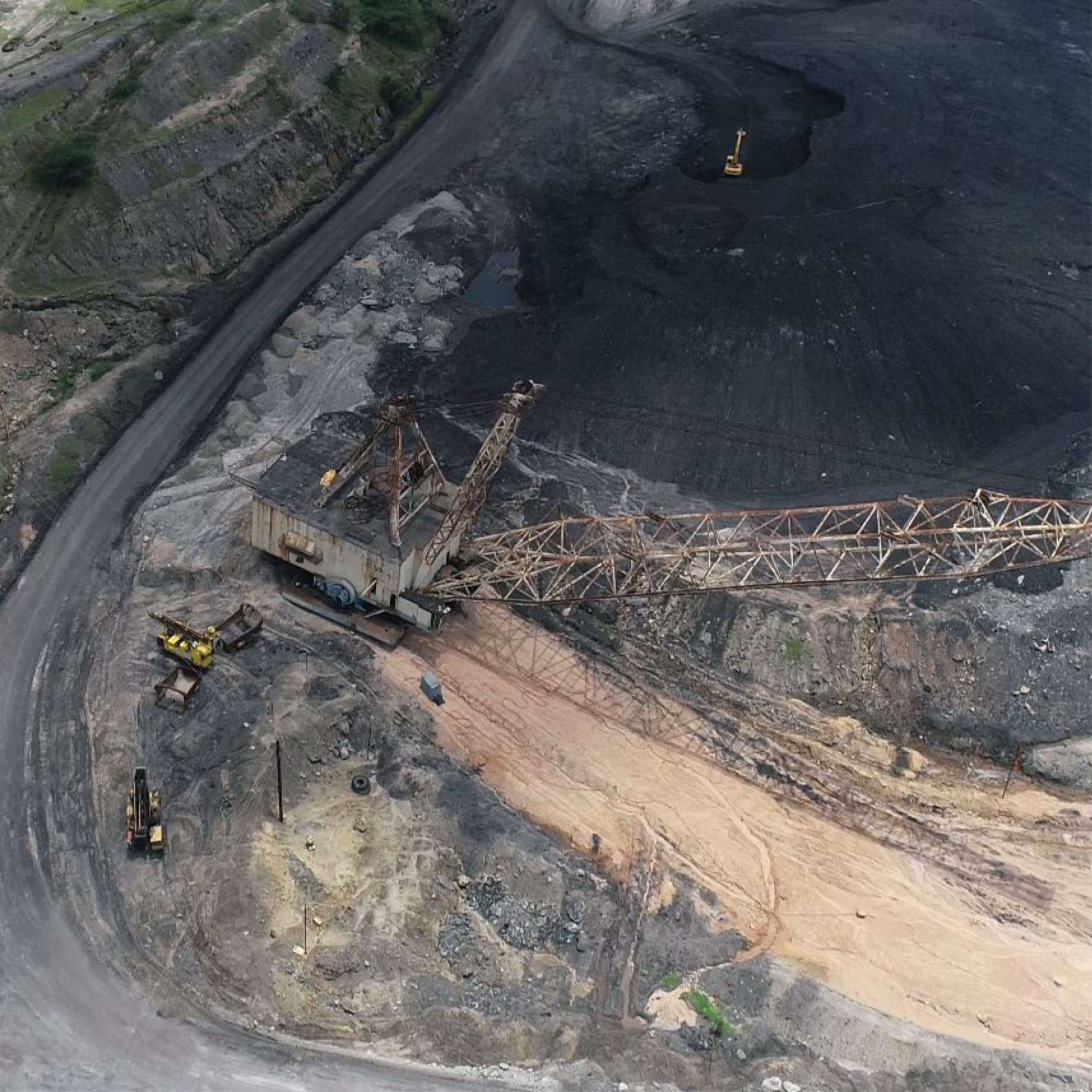
Site Operations
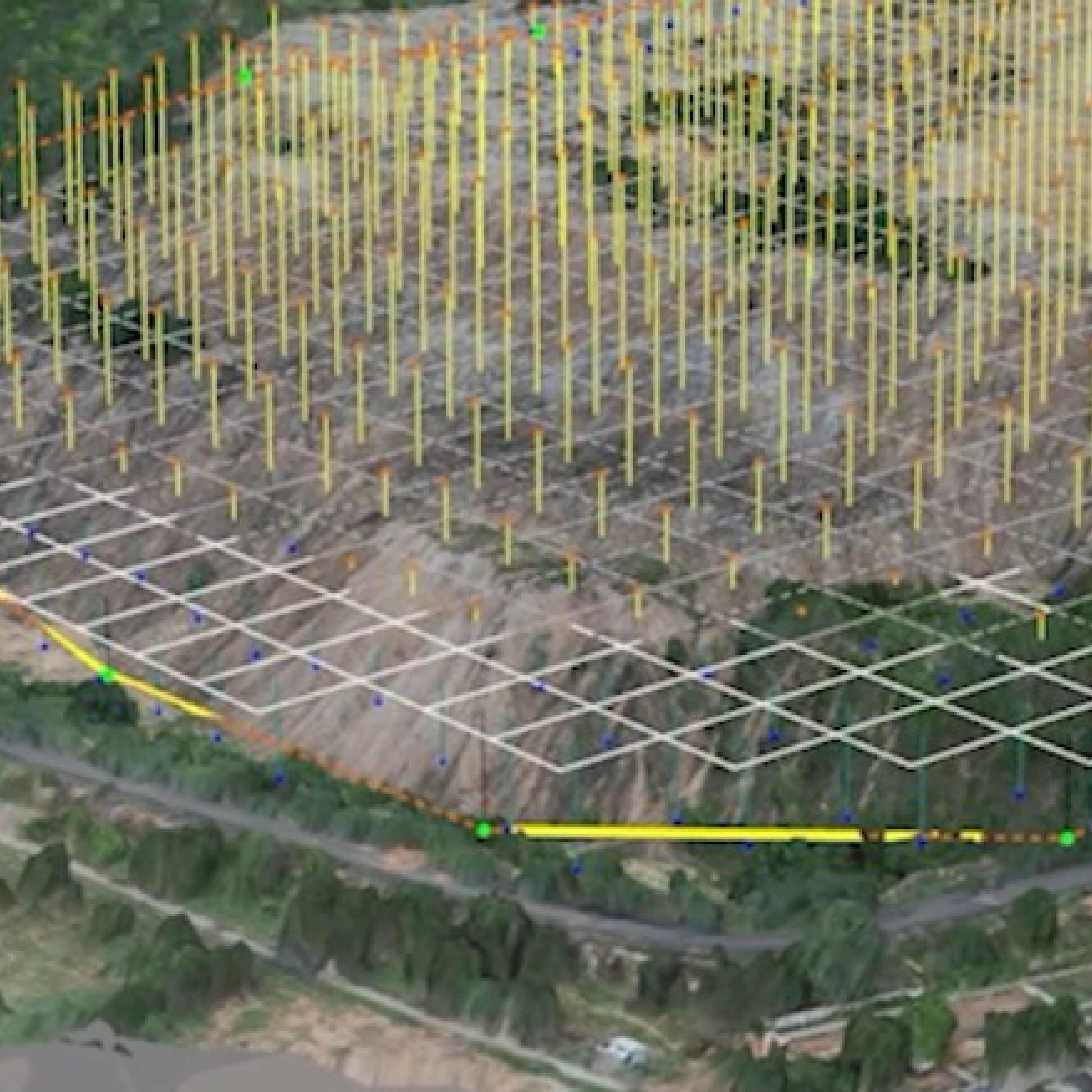
Digital Twins
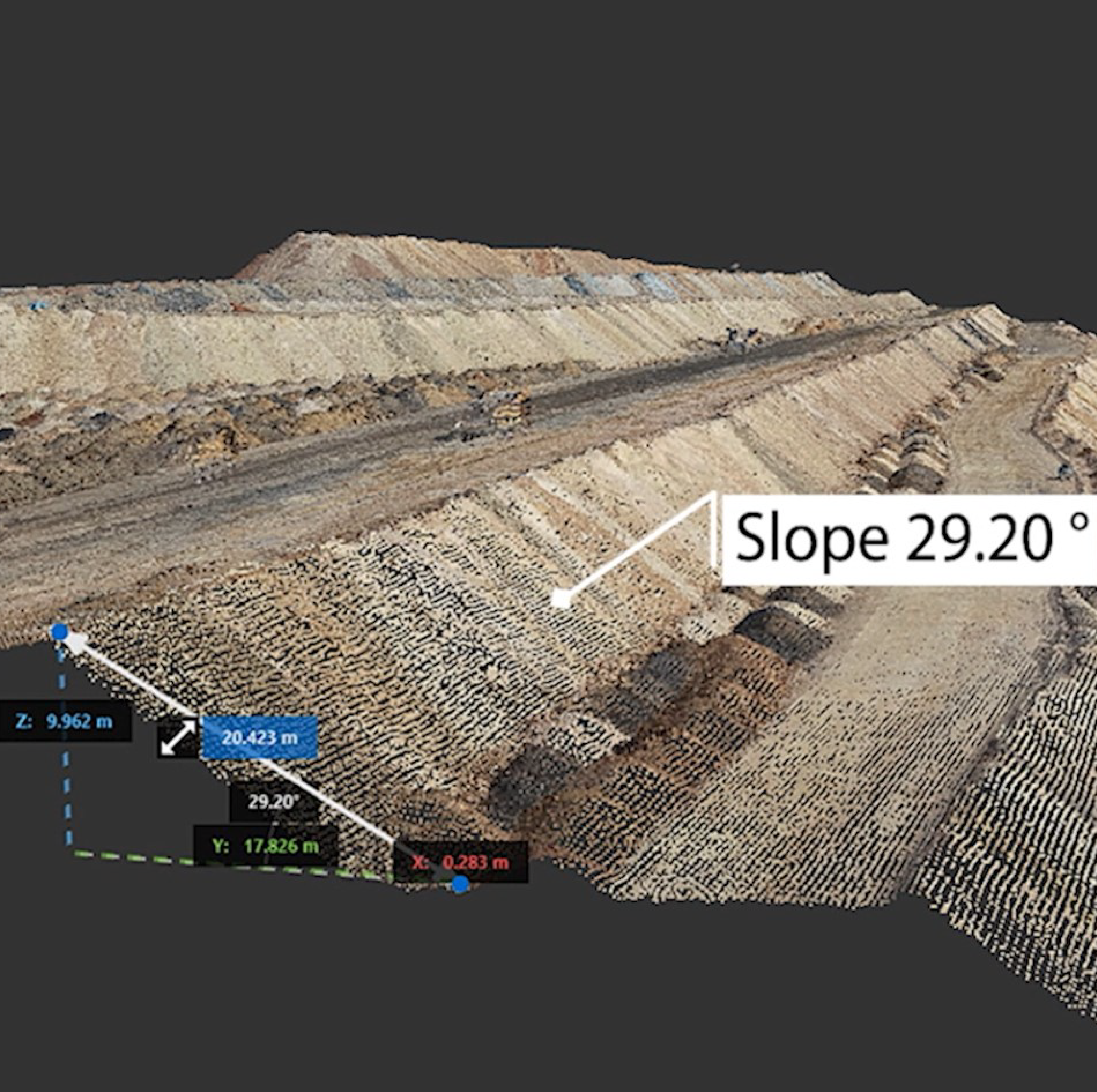
Compare Site Reality vs. Digital Terrain Model (DTM)
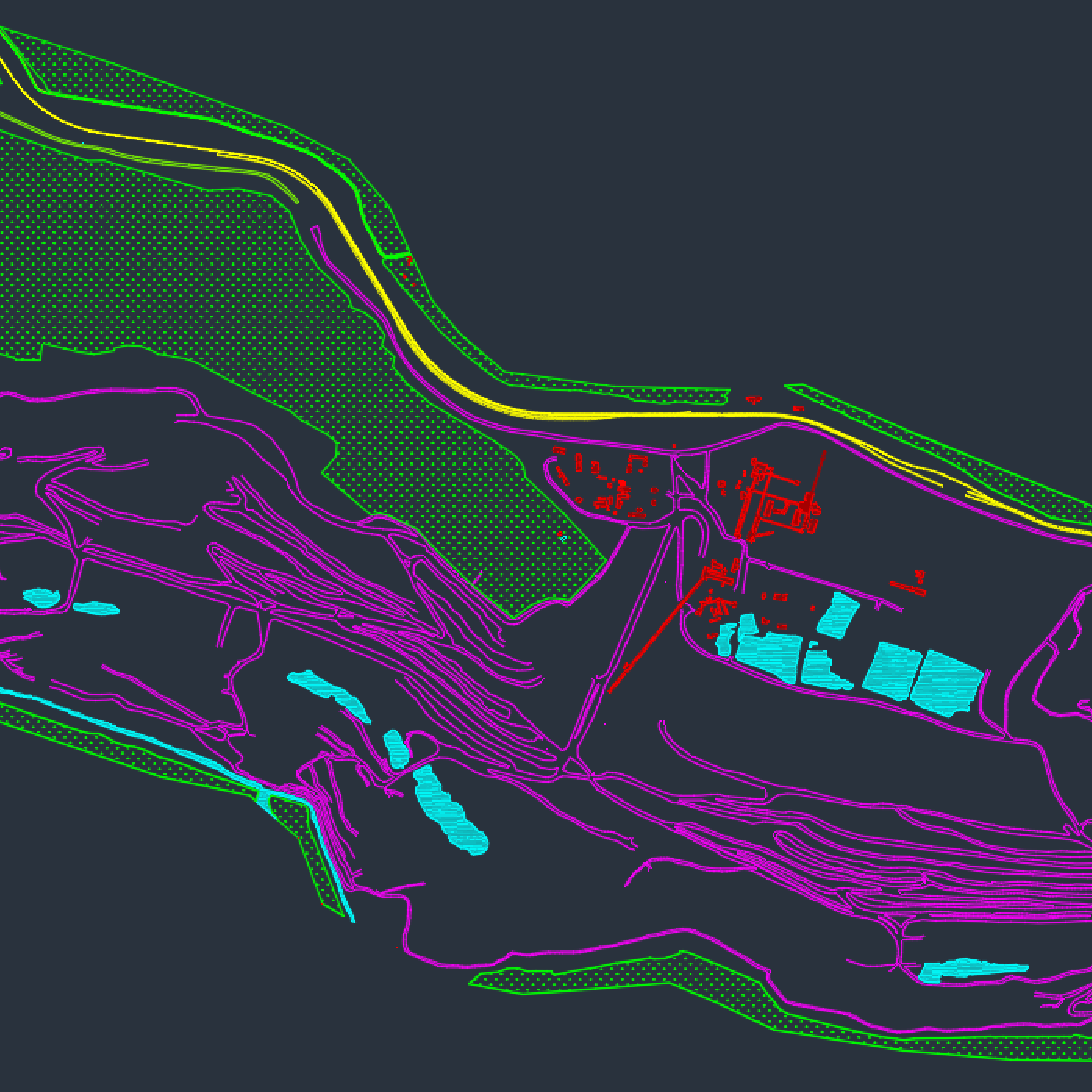
Mining Deliverables
Frequently Asked Questions
How accurate is drone-based Volumetric Analysis for stockpiles and pits?
Droid Survair provides 99% accurate volume calculations. By capturing millions of data points via drone photogrammetry or LiDAR, we create a dense 3D mesh of the stockpile. This eliminates the "estimation errors" common in traditional manual surveying, ensuring precise inventory management for minerals and coal.
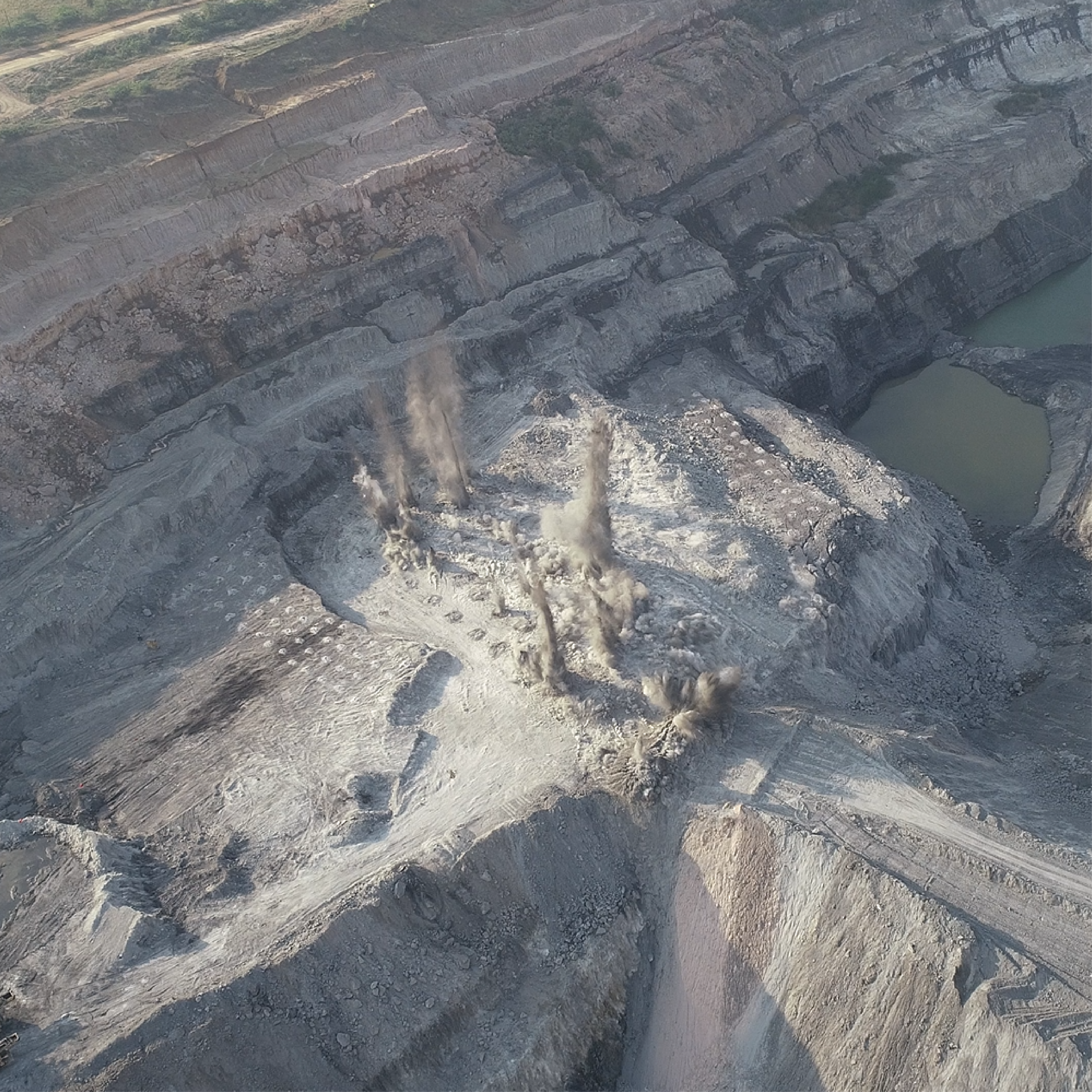
Can drones improve safety in high-risk mining environments?
Absolutely. Drones allow for High-Wall Monitoring and pit inspections without sending surveyors into dangerous zones. We can detect structural cracks, bench instabilities, and potential slide areas from a safe distance, significantly reducing the Risk Priority Number (RPN) for mine operators.
What is the turnaround time for a full mine site Digital Twin?
Traditional ground surveys of large mines can take weeks. With our high-end UAVs, we can map hundreds of hectares in a single day. The final Digital Twin and Orthomosaic are typically delivered within 48-72 hours, allowing mine managers to make faster, data-driven decisions.
How does Droid Survair assist in Mine Lease boundary and Encroachment monitoring?
Using DGPS-rectified drone data, we provide centimeter-level accuracy for Lease Boundary Mapping. This helps mining companies ensure they are operating strictly within their permitted zones and provides legal-grade evidence to prevent or identify external encroachment.
Are the drone survey outputs compatible with standard mining software?
Yes. All our deliverables are provided in industry-standard formats like .DWG, .DXF, .LAS (Point Cloud), and .TIFF. These integrate seamlessly with specialized mining software such as Surpac, Minescape, AutoCAD Civil 3D, and ArcGIS.
Maximize Productivity & Safety
Get precise data for your mining operations today.
Request Mining Survey