Precision Underwater Mapping
Bathymetric Survey Solutions
Deep Water Intelligence
With the help of underwater drones, we can precisely measure the depth of water in oceans, seas, lakes, or any other water bodies. We can also attach echo sounders to our regular drones for bathymetry surveys.
Advanced Equipment
High-resolution sensors and custom USVs ensuring data integrity in challenging waters.
5x Faster Delivery
Our dedicated GIS experts work around the clock to process hydrographic data swiftly.
10x Faster Acquisition
Rapid aerial and autonomous underwater data gathering reduces time on site significantly.
99% Accuracy
Machine Learning processing allows for precise volumetric measurements and sediment analysis.
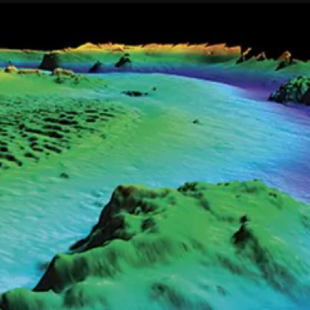
Surface vs Sub-Surface Analysis
Visualizing underwater topography overlaid with satellite imagery.
Key Deliverables
High-resolution outputs from our hydrographic surveys.
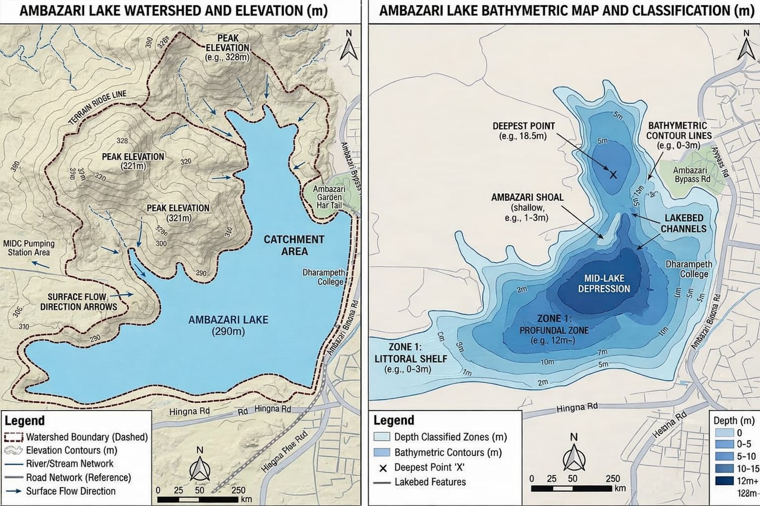
Bathymetric Contour Map
Detailed depth iso-baths and topography.
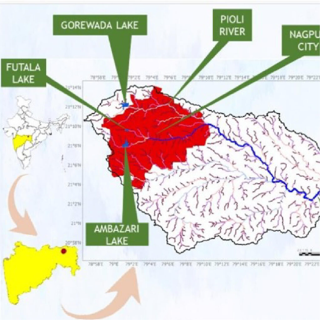
Watershed Analysis
Catchment area and flow modeling.
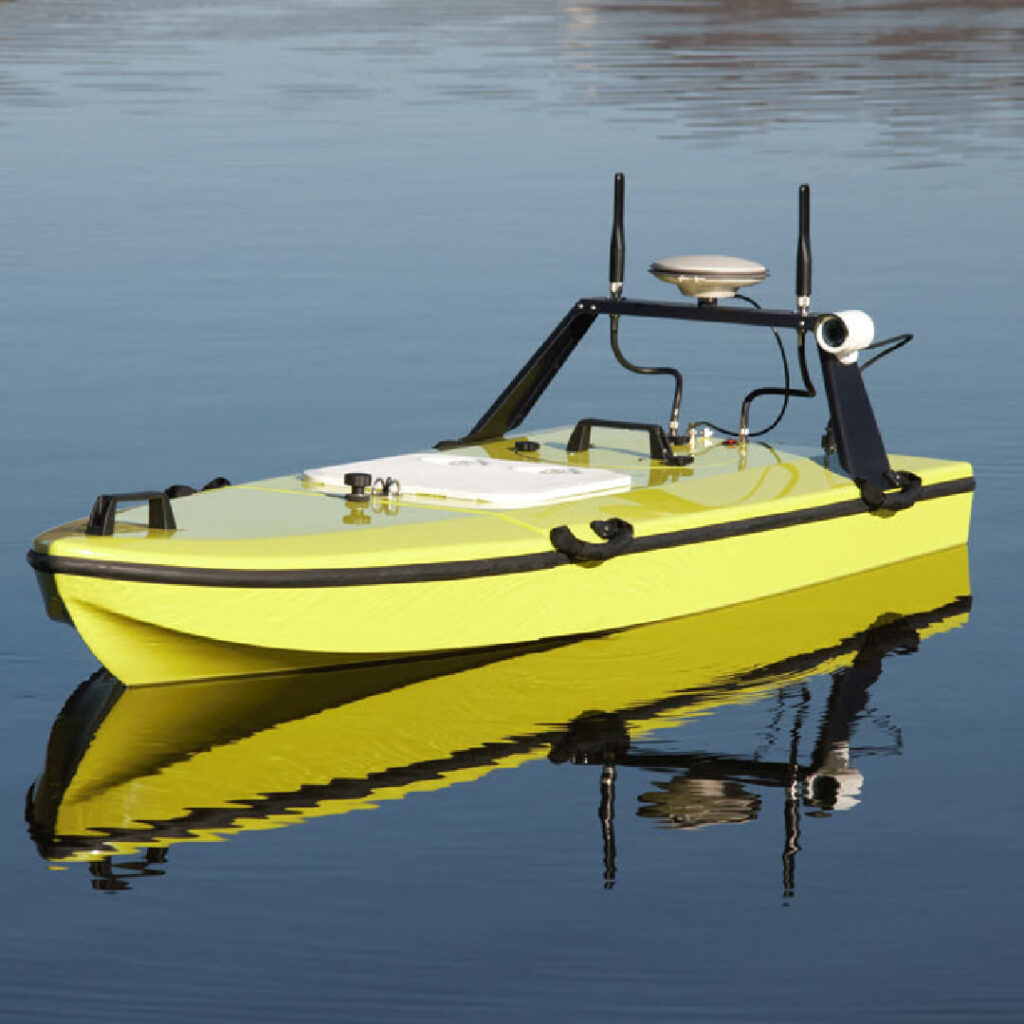
Hydrographic Data Acquisition
Raw sonar data collection via USV.
Frequently Asked Questions
Explore What Lies Beneath
Contact us for precise Bathymetric and Hydrographic survey quotes.
Request Bathymetric Survey Quote