Precision Hydrology & Water Management
Water Resource Intelligence
With our advanced drone and sonar technology, we provide precise measurements of water depth, volume, and flow characteristics for any water body. We assist in effective watershed management, dam safety inspection, and flood mitigation planning.
Core Services
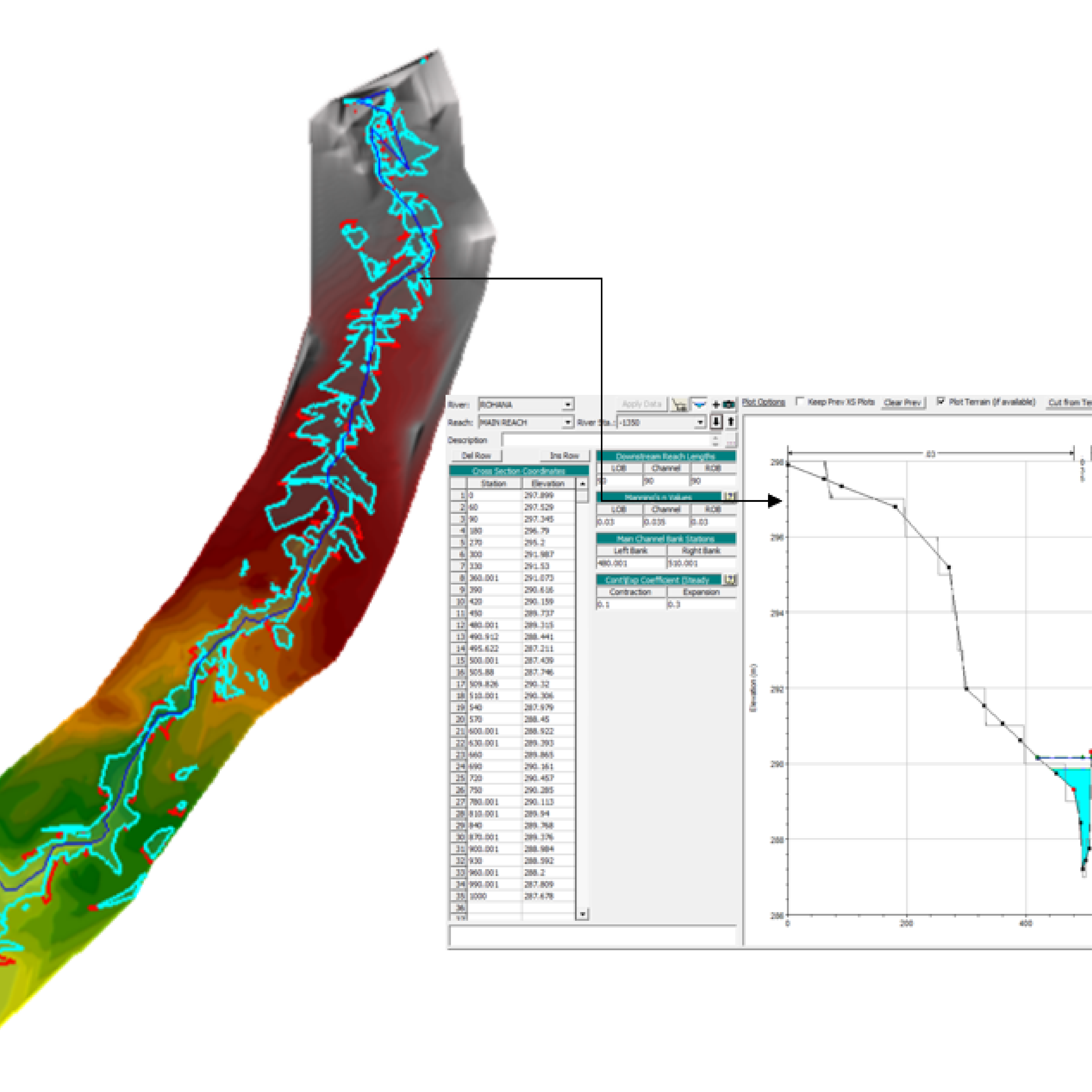
Topography Survey
High-resolution terrain models for flood and irrigation planning.
Dam Inspection
Structural and thermal monitoring for safety and compliance.
Bathymetric Survey
Precise underwater depth and volume measurements.
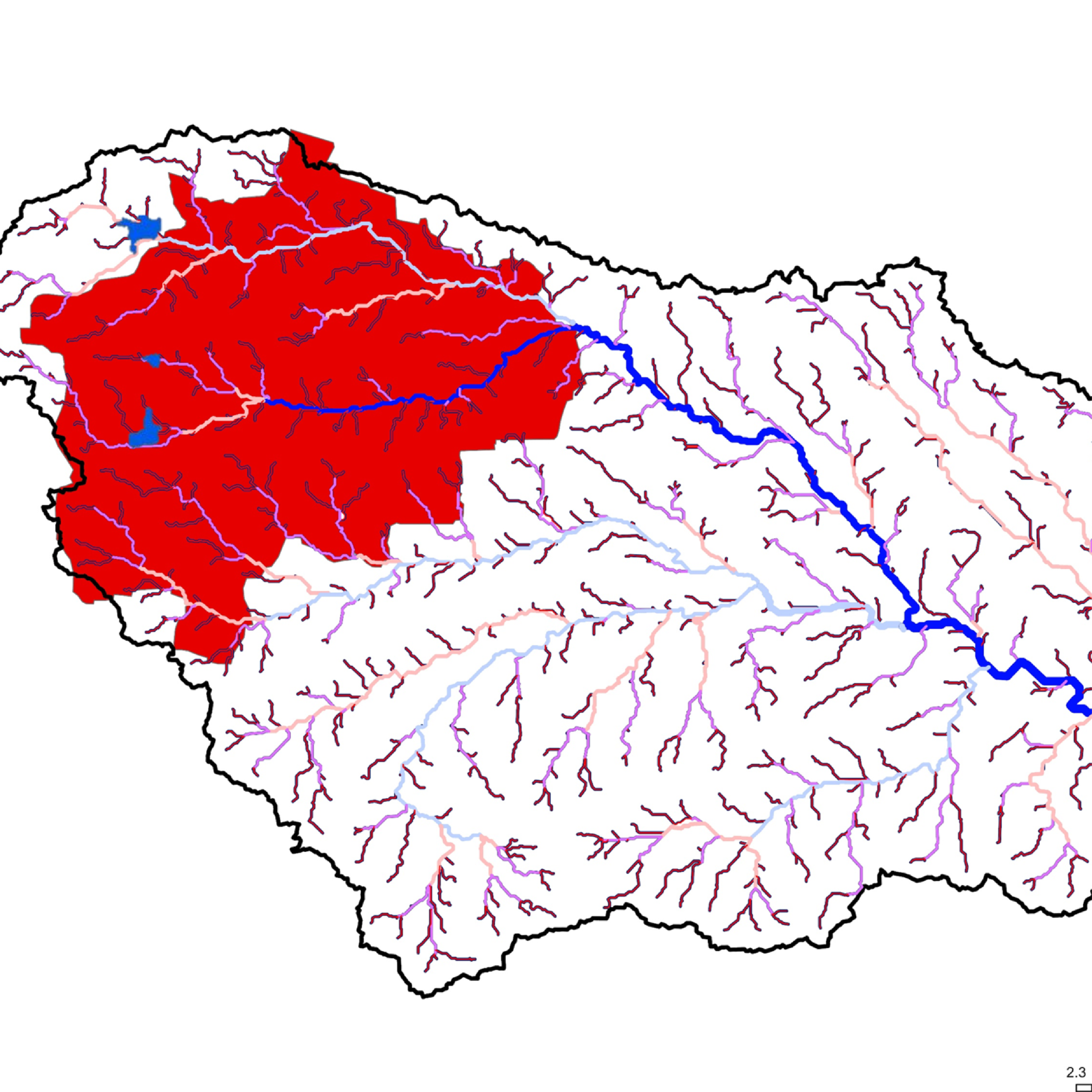
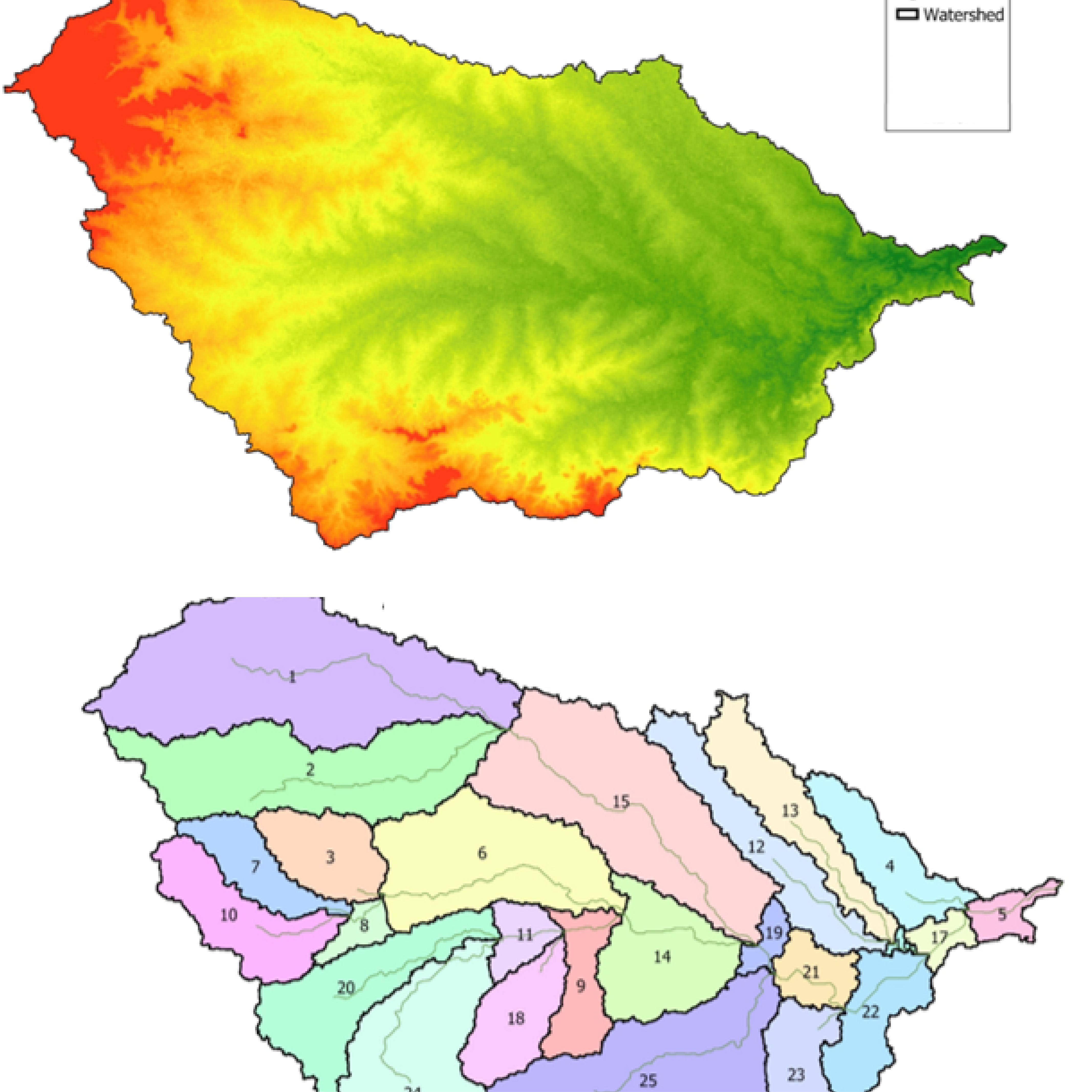
Watershed Analysis
Mapping drainage patterns and catchment areas.
Live Flow Modelling
Flood Prediction
Simulate water levels to assess risk and plan mitigation.

Analysis Deliverables
Frequently Asked Questions
How does drone technology improve Hydrological and Hydraulic (H&H) modeling?
Accurate H&H modeling requires high-precision topographical data. Droid Survair provides survey-grade Digital Elevation Models (DEM) and contours that capture the micro-topography of the land. This allows hydrologists to simulate water flow, predict flood zones, and design drainage systems with much higher reliability than traditional satellite data.
Can drones accurately map catchment areas and watersheds in hilly terrains?
Yes. Our drones, especially those equipped with LiDAR sensors, can map vast and inaccessible catchment areas with centimeter-level precision. This data is essential for calculating runoff coefficients, identifying natural drainage paths, and planning effective watershed management strategies.
What is the importance of drone-based Flood Plain Mapping for urban planning?
Urban flooding is a major challenge in 2026. Drone-based Flood Plain Mapping identifies low-lying areas and potential bottlenecks in the drainage network. This high-resolution data helps city planners and engineers design flood mitigation structures and set safe floor levels for new constructions.
How do you integrate Bathymetric data with Hydrological surveys?
For a complete hydrological study, we merge Underwater Bathymetry (riverbed/lakebed levels) with Terrestrial Topography (bank levels). This creates a "Seamless Surface Model" that is critical for river morphology studies, bridge scour analysis, and dam breach simulations.
Why is LiDAR preferred over Photogrammetry for drainage analysis?
Drainage paths are often hidden under thick vegetation or grass. LiDAR laser pulses can penetrate this vegetation to hit the actual ground, providing a "True Ground" DTM. Photogrammetry only sees the top of the grass, which can lead to errors in calculating water flow directions and slope analysis.
Analyze Water, Predict the Future.
Gain critical intelligence for secure water management.
Request Hydrological Study