GIS & Remote Sensing
Transforming Geospatial Data into Actionable Insights
Expertise & Solutions
Droid has extensive expertise in analyzing and processing spatial vectors and raster data. We offer the complete solution of GIS and remote sensing techniques for the ease of client’s decision-making.
We have proficiency in generating land use land cover maps, watershed analysis, geospatial modeling, network analysis digitization, etc. using various satellite images and GIS and remote sensing software.
Our Capabilities
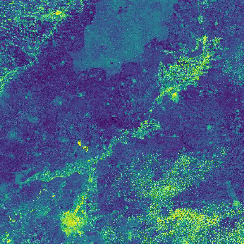
Land Use / Land Cover Maps
Detailed classification of land features using multi-spectral satellite imagery to monitor vegetation, water bodies, and urbanization.
Watershed Analysis
Hydrological modeling to map drainage basins, flow direction, and catchment areas for effective water resource management.
Geospatial Modeling
Advanced spatial analysis and 3D modeling to simulate environmental scenarios and urban development patterns.
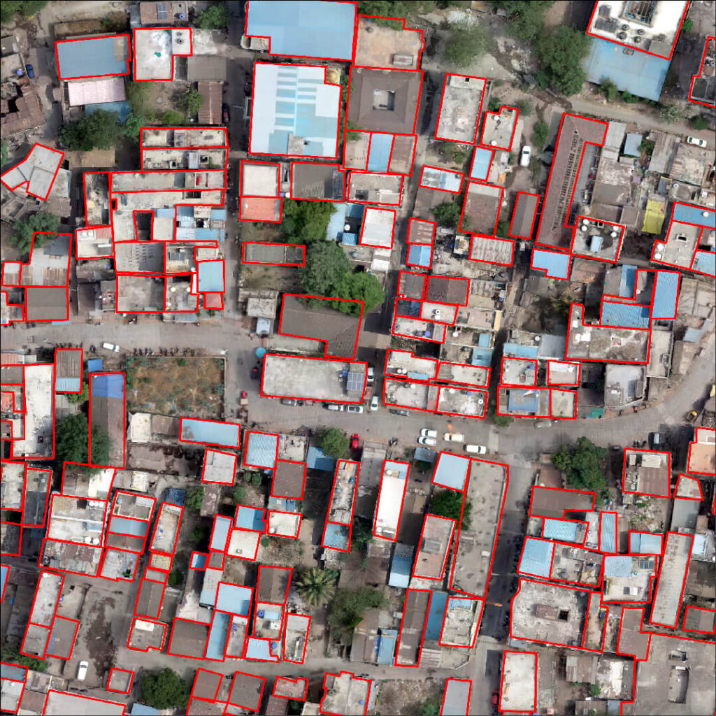
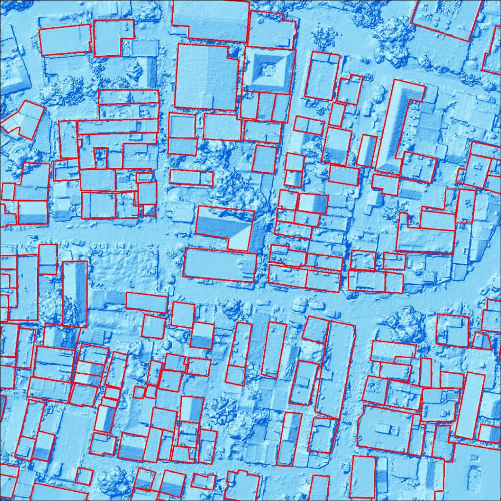
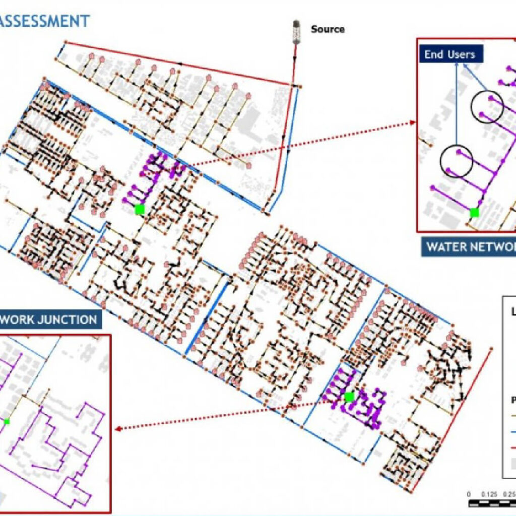
Network Analysis Digitization
Precision mapping of utility networks (pipelines, electric grids) and transport routes for optimization and asset management.
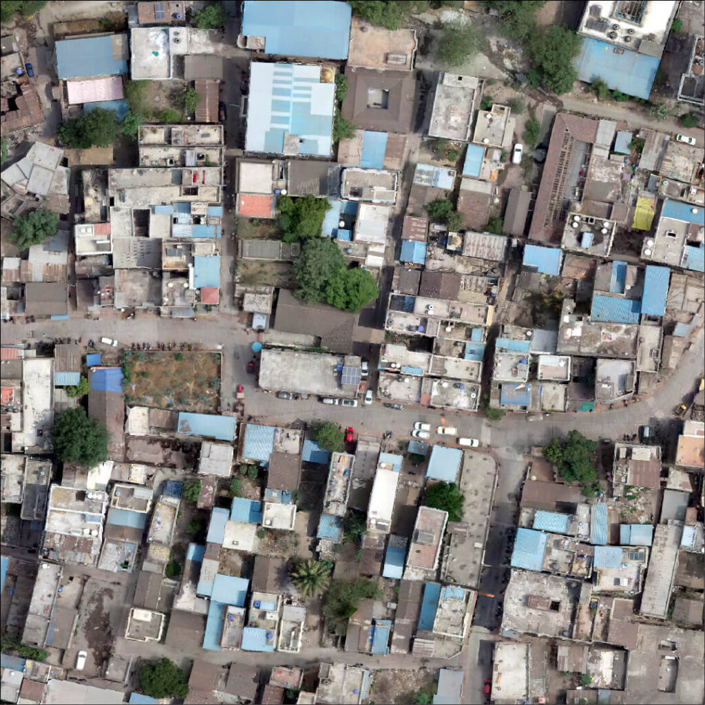
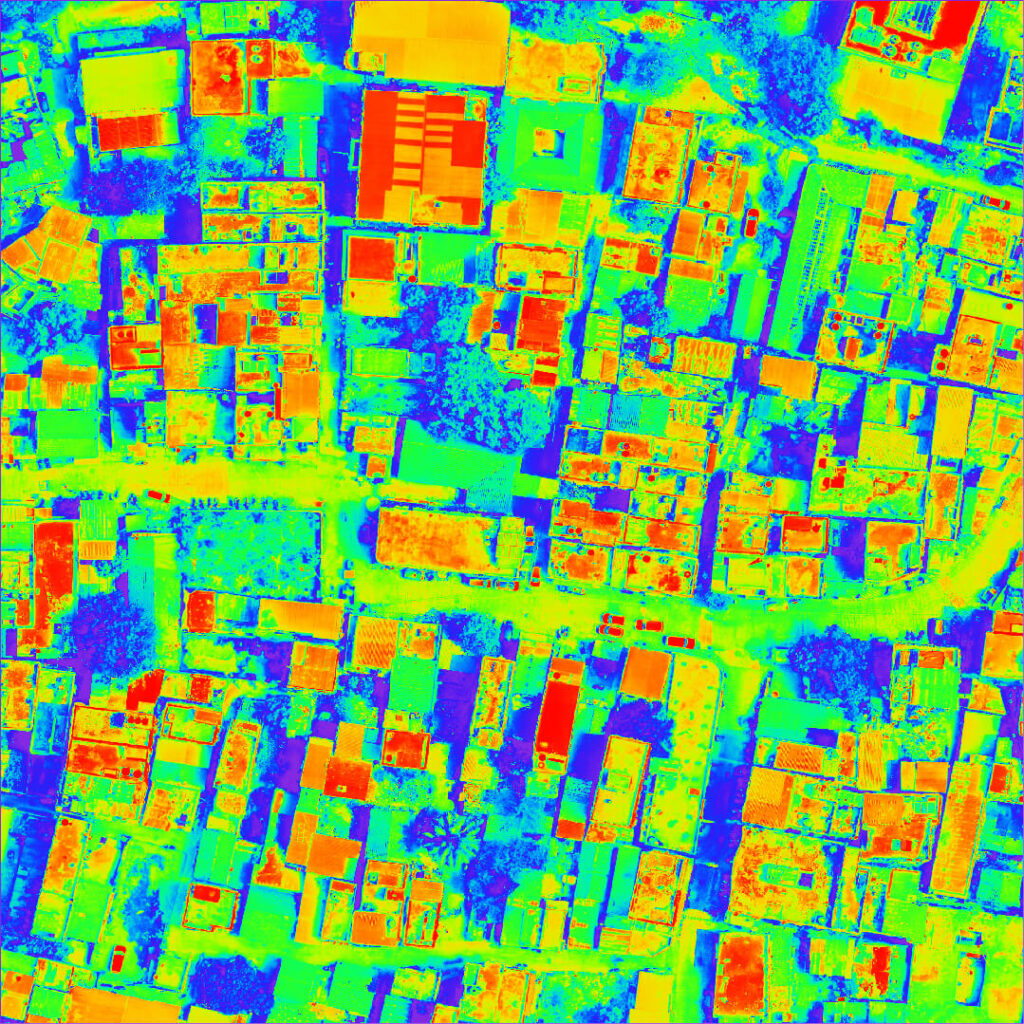
Digitization in Action
Drag the slider to see how we convert raw imagery into digital maps.
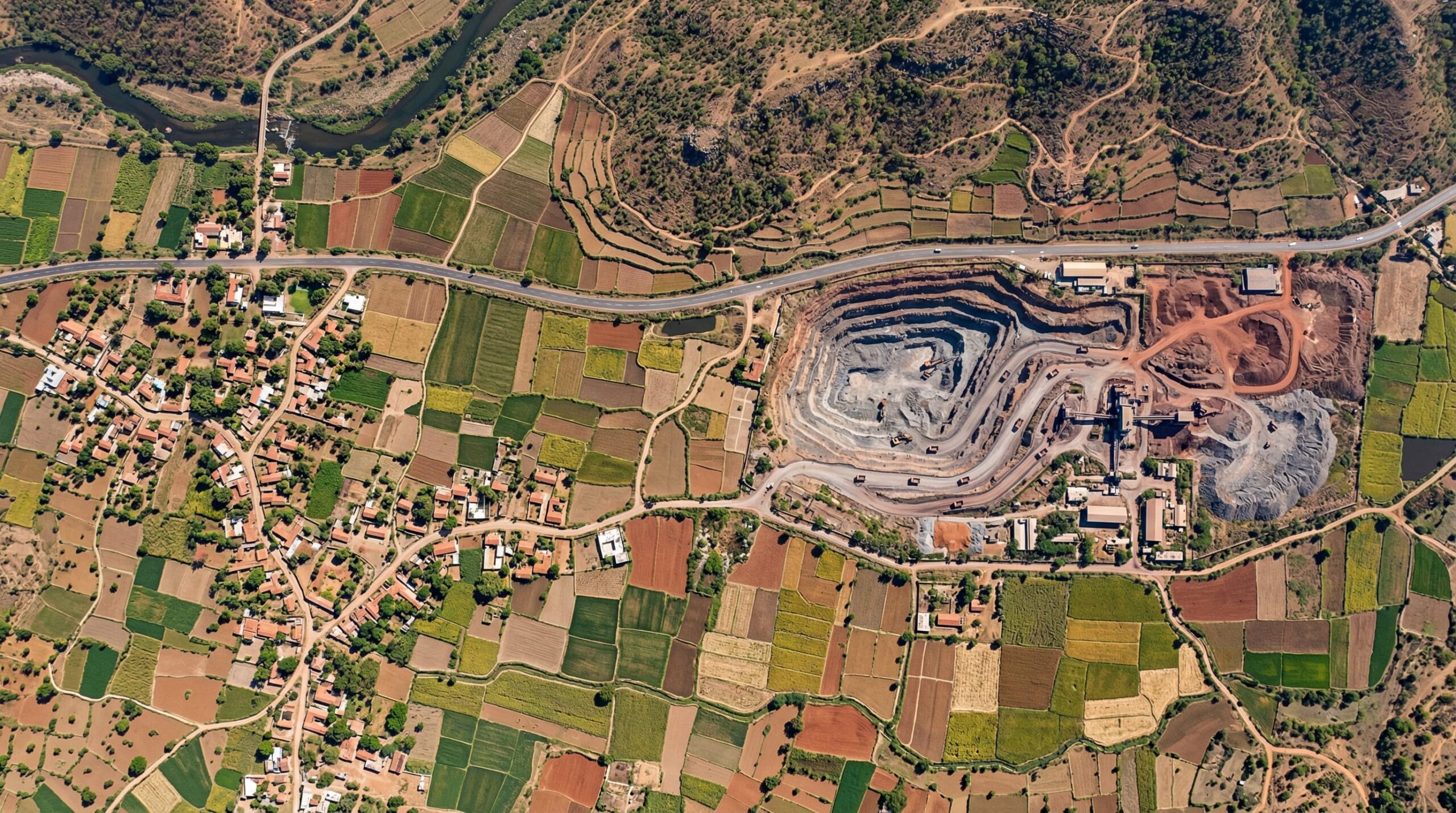
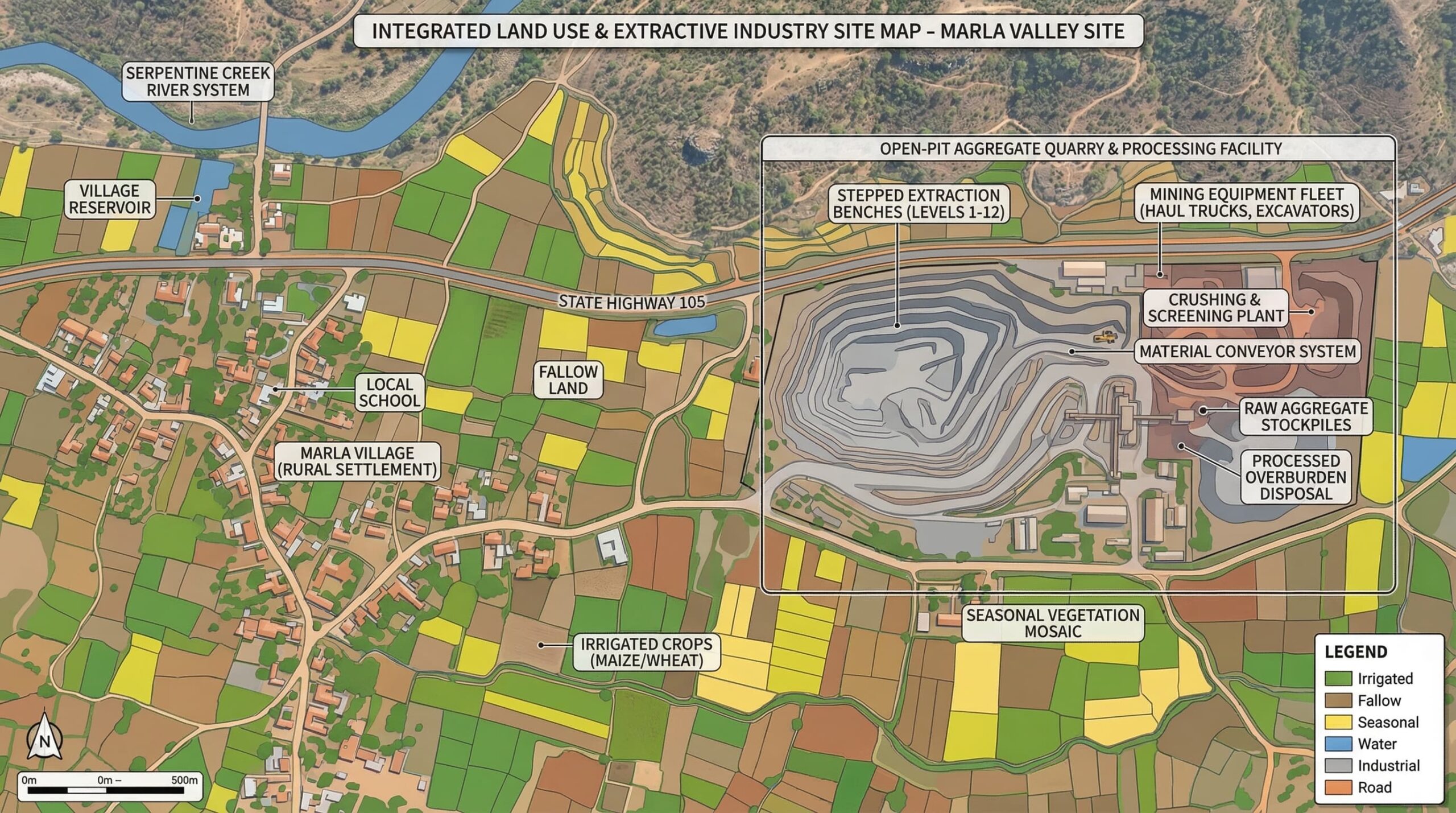
Recent Projects
High-resolution outputs from our GIS processing.
Why Choose Us?
Advance Equipment
High-end drones and sensors for superior data quality and topographic precision.
5x Faster Delivery
GIS experts working round the clock to ensure timely delivery of drawings and reports.
10x Faster Acquisition
Skilled pilots gathering aerial info faster than traditional methods.
99% Accuracy
Machine Learning processing for precise yield estimation and volumetric measurements.